In the world of transport planning, the ability to effectively classify and visualize routes and services within public transport networks is crucial for understanding service patterns, analyzing coverage, and making informed decisions. Podaris offers powerful tools that make this process intuitive and efficient. In this blog post, we'll explore how Podaris can be used to classify bus networks, offering advantages over traditional methods and competing solutions.
The Power of Route Attributes
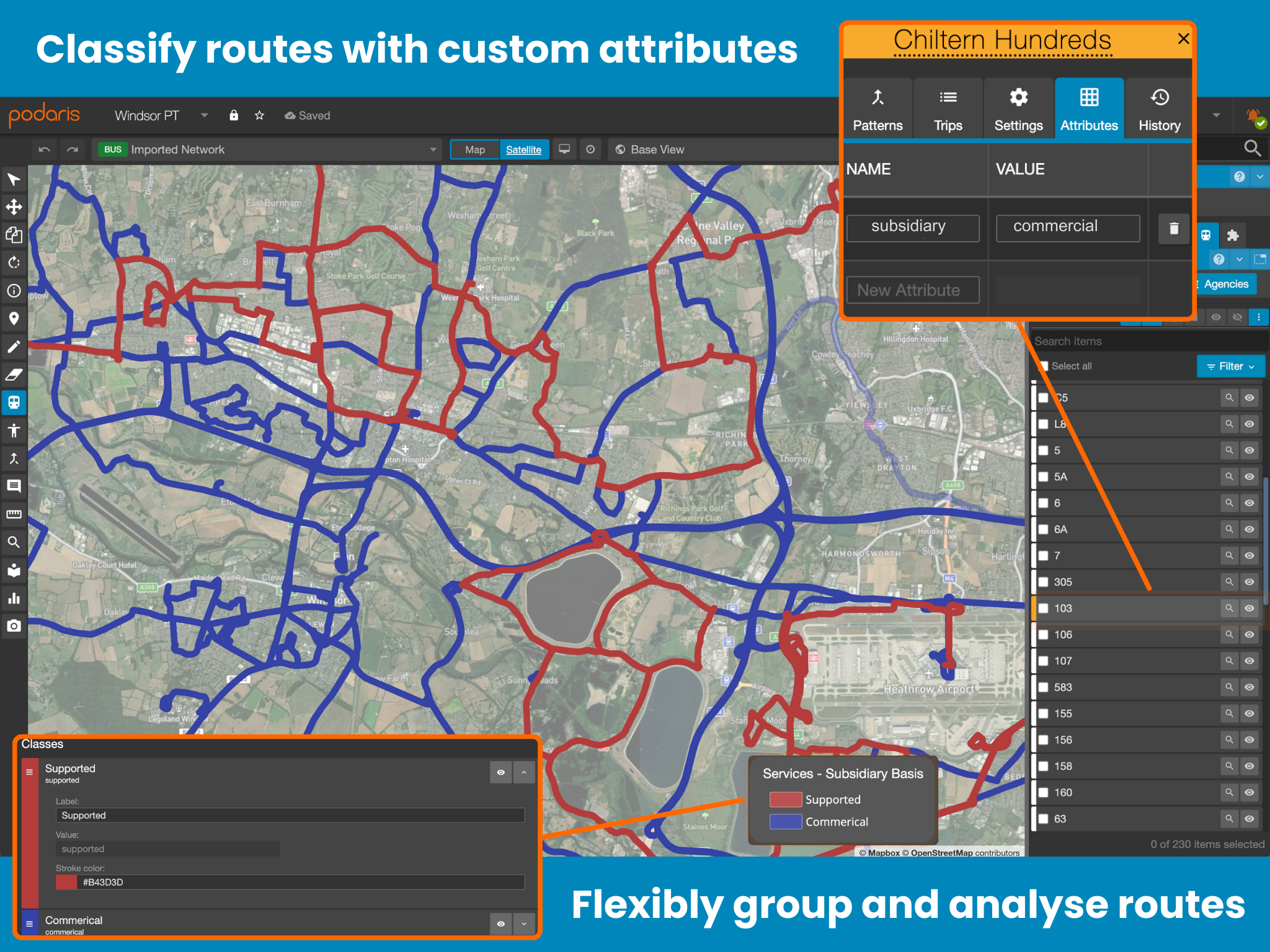
At the heart of Podaris’ network classification capabilities lies its flexible route attribute system. Like a GIS tool combined with a Spreadsheet, Podaris allows planners to create custom attributes that can represent any aspect of a route's characteristics.

Here's how it works:
-
Create Custom Attributes: In the route settings, planners can add any number of custom key-value pairs. For example:
- “Service Type”: “Express”
- “Patronage Level”: “High”
- “Subsidy Status”: “Fully Supported”
-
Flexible Values: Attribute values aren't limited to predefined options. You can use any string value, allowing for nuanced classification.
-
Multiple Attributes: Each route can have multiple attributes, enabling multi-dimensional classification schemes.
Visualizing Your Classifications
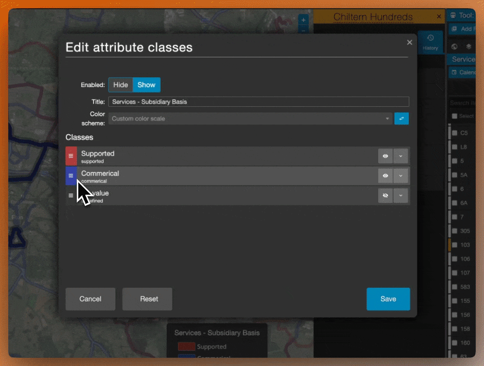
Once you've set up your attributes, Podaris makes it easy to visualize them with Display Settings:
-
Color-Coding: Use the display settings to color-code routes based on any attribute. This instantly creates a visual representation of your classification scheme.
-
Automatic Legend: Podaris generates a legend for your color-coding, making it easy to understand the visualization at a glance.
-
Toggle Visibility: Easily show or hide routes based on their attributes, allowing you to focus on specific subsets of your network.
Advanced Analysis with Attributes
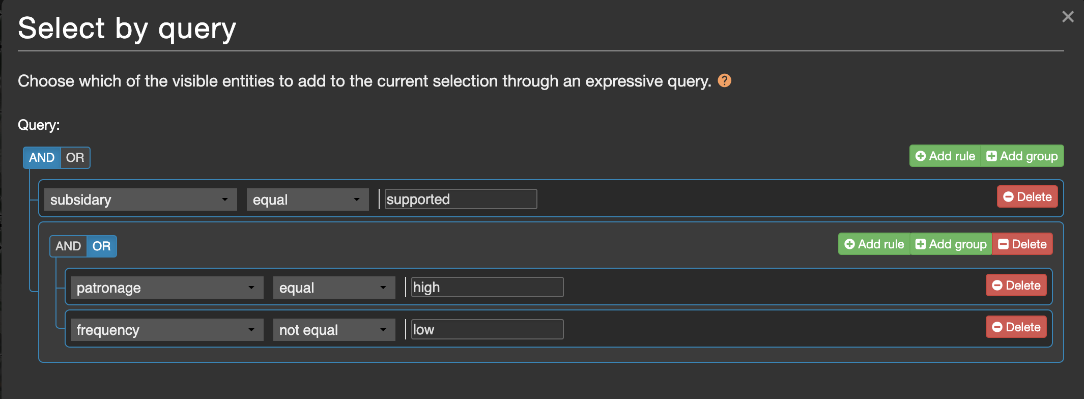
The real power of Podaris’ attribute system comes into play when you start using it for analysis:
-
Filtering: Use attributes in selection queries to quickly isolate routes with specific characteristics.
-
Comparative Analysis: Easily compare different subsets of your network by toggling visibility based on attributes.
-
Scenario Planning: Create multiple scenarios with different attribute assignments to explore various classification schemes.
Beyond Simple Classification
Attributes seamlessly work with all of Podaris’ analysis tools, allowing planners to gain deeper insights into their networks.
-
Integration with Other Features: Use your classifications in conjunction with Podaris’ isochrone analysis, demand modeling, and journey planning tools for comprehensive insights.
-
Temporal Analysis: Combine route attributes with Podaris’ project clock to understand how your network classification changes throughout the day or week.
-
Multi-Modal Integration: Apply similar classification techniques across different modes in your network for a holistic view of your entire transport system.
Real-World Application
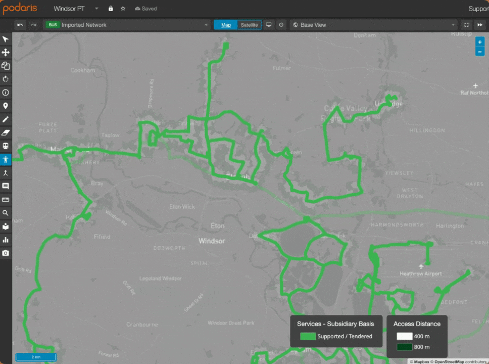
Let's look at a quick example of how this might work in practice:
- Classify routes by service level (e.g., “High Frequency”, “Standard”, “Peak Only”)
- Add an attribute for subsidy status (e.g., “Commercial”, “Partially Supported”, “Fully Supported”)
- Color-code the network based on service level
- Use the visibility toggles to show only commercially viable high-frequency routes
- Perform an isochrone analysis to understand the coverage of these premium services
This type of analysis can quickly highlight areas where high-quality service might be lacking or where there are opportunities to enhance commercial viability.
Summary
Podaris’ approach to bus network classification offers unparalleled flexibility and analytical power. By combining custom attributes with intuitive visualization tools and advanced analysis features, Podaris empowers planners to gain deeper insights into their networks and make data-driven decisions with confidence.
These route classification capabilities have been used to support Bus Service Improvement Plans (BSIPs) across England, network reviews in Australia, and strategic redesigns in the United States.
Ready to revolutionize how you classify and analyze your bus network? Contact us for a demo and see Podaris in action!