
Early stage transport planning can involve many facets, from approximating route distance and travel time, to exploring the potential impact of service alterations on mode shift and accessibility. For the consumer, the most pressing question is often, “how can I actually get from A to B?”
Podaris’ Journey Planner allows you to generate a comprehensive, multimodal overview of journeys to and from designated locations. Because the journey planner updates with each revision to your network, it allows you to gain an at-a-glance understanding of how journeys are actually made, and the potential real-world impacts of route alterations such as timetable amendments and diversions. If you've used the Directions feature in Google Maps, for instance, you'll be familiar with this sort of journey planning.
With Podaris however, every update made to your services is reflected in updates to the journey planner. This allows you to make proposed bus services active or inactive in your network, for instance, to quickly visualise how they might improve accessibility in a region. It allows you to understand how seemingly minor alterations to a service in the form of timetable changes or the removal of stops may lead to more significant knock-on effects for travellers.
Creating a journey plan
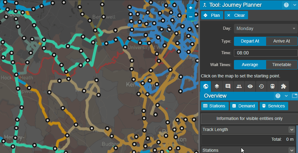
Creating a journey plan in Podaris is easy and begins with selecting the start and end points of your journey on the map, as well as the day and time of travel. These days and times take into account the trips that you create with Podaris’ service scheduling tool. These are scheduled services that comprise routes made up of a number of inbound and outbound route patterns. These services can either be created from scratch or imported (and then edited if necessary) from GTFS or TransXChange feeds.
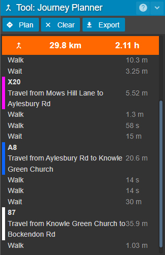
Where multiple possible routes between your specified start and end points are available, Podaris will generate a list of journeys, with the shortest method of travel at the top. Podaris is completely multimodal and allows for traditional modes such as rail and bus to sit alongside more exotic modes such as personal rapid transit (PRT) and hyperloop. All of these may be combined in a single journey.
Your journey plan shows all necessary transfers needed to complete that journey, as well as the distance and overall journey time, including wait times. As a fast and infrequent service may not necessarily be preferable to a slower but more frequent alternative, it's important to have a clear understanding of the wait times associated with your journey. Podaris allows you to account for wait times in one of two ways:
Average: this is the default mode and is based on an average representation of the frequency of the service - generally this will be half of the headway.
Timetable: this uses the exact departure times specified as part of your service schedule to calculate wait times.
Once you've created a journey plan, all the data contained within can be easily exported as a geospatial JSON file that features a comprehensive breakdown of all steps on that journey including wait times and their associated distance and duration, for use in third party GIS tools.
To see how Podaris’ journey planner works as part of Podaris’ comprehensive planning and analysis platform schedule a demo with us today and discover how Podaris can help accelerate your transport projects.