Podaris is a powerful and flexible platform that allows for analysis and visualisation of geospatial data in moments. It’s intended not only to fill a gap identified in the transport planning market, but also to be compatible with other analysis tools, extending its capabilities. One such piece of software that pairs very well with Podaris is QGIS.
Recently, one of our customers needed to perform accessibility analysis on a particular region, taking into account a period over time. One of the most powerful tools on the Podaris platform is its ability to easily create isochrones in order to visualise and conduct quantitative analysis of accessibility, whether by transit, by bicycle or on foot. However, it considers only a specific time, like a photograph of the exact moment when the person left the place.
In order to better understand a scenario that covers a longer period of time, we can combine Podaris’ isochrone tool with other tools found in QGIS to perform more complex analyses. These type of analyses make it possible to observe the behaviour of users who may slightly modify their routine and arrive sooner or later at the nearest transport point.
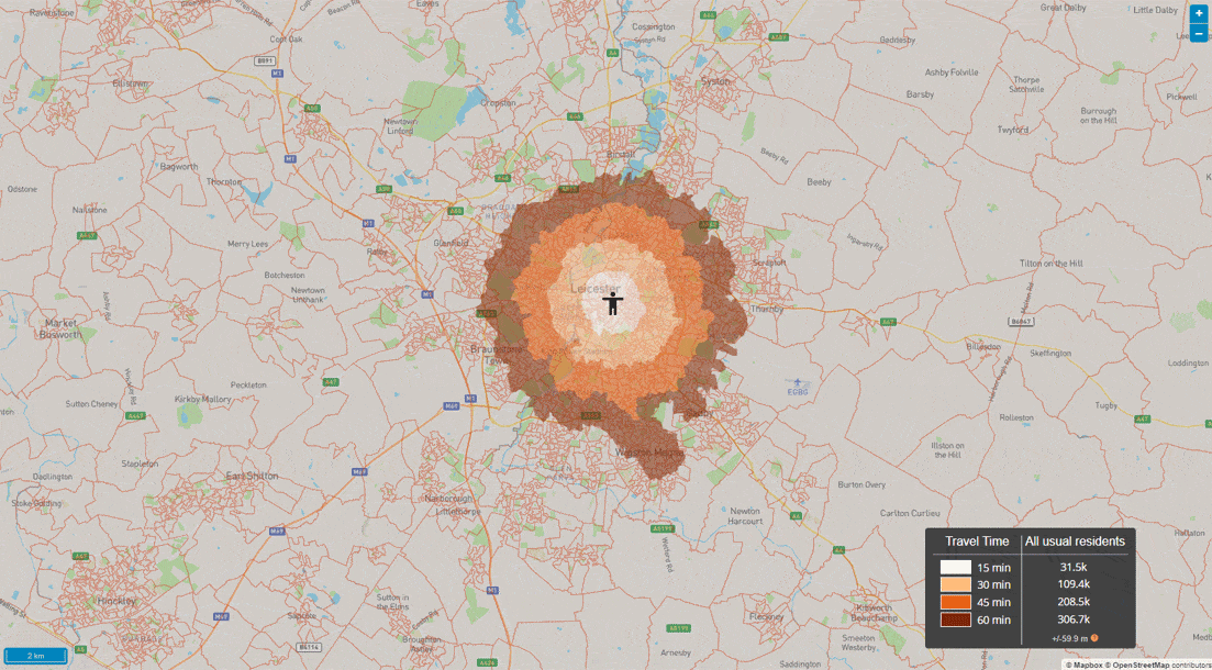
Our client’s need was to visualise the degree of accessibility of a public transport network within a period of 1 hour. For this, Podaris has the demand simulation analysis tool that can generate accessibility zones over time. However, the client wished to present their results as isochrones, in order to cross reference demographic data with accessibility visualised in the territory.
To find the desired result it would be necessary to combine a series of isochrones of equal periods to find what the maximum range would be in that desired period. Our client decided to split trips every 10 minutes from a certain train station. As an example, we will use Leicester City Rail Station here as a starting point and look at accessibility via the local bus network on a Sunday between 8:00 and 9:00 AM.
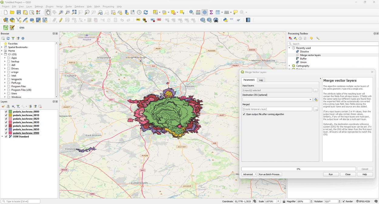
In order for us to analyse the entire hourly period, we will create isochrones for every 10 minutes (shown above) and export them as geometric polygons in the GeoJSON format. With QGIS, we open each of the isochrone files generated in the same project and combine them in the same layer using the merge vector layers tool that is available in the processing toolbox. This creates a result where each of the schedules is present in the final file.
The next step is to dissolve the lines in the file with the information from the different isochrones merged together. This tool can also be found in the processing toolbox. For the information to be accurate and the processing to be completed, it is necessary to open the advanced options menu and select the option to “filter invalid features”, which will ignore them. In addition, it is necessary to select the stepBoundaryTime field so that the dissolution is processed correctly, making it possible to execute the action.
The final result is ready to be used in analyses with cross-sectional data, which is possible in Podaris.
To find out how Podaris empowers a wide range of geospatial analysis head over to www.podaris.com and discover a new way to plan and analyse collaboratively.