“School streets” initiatives date back as far as the late 1980s, to Bolzana, Italy. The concept is simple but the benefits are significant - traffic outside of schools is restricted during pick up and drop off times, opening the streets for walking and cycling. It took the UK 26 years to introduce its own first school scheme in Scotland in 2015. England followed suit two years later with its first scheme in Camden, London.
Apart from promoting a more pleasant environment for children and their families, school streets strategies also contribute to safer streets with far fewer collisions (43% fewer collisions during holidays during school run times).
Perhaps unsurprisingly, the highest number of serious casualties of under 16s also occur between 15:00 and 15:59 (school pickup time). The School Streets Initiative website points to the irony of a situation where “traffic makes the roads unsafe so parents will drive their children everywhere.”
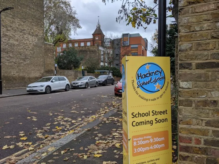
School streets implemented in Hackney, London
The other major benefit of school streets is the improvement of air quality in the surrounding areas. In a 2021 air quality monitoring study exploring the effect of school streets in London, the “resultant reduction in nitrogen dioxide during the school drop-off period has been estimated as being up to 23%".
Ultimately, school streets represent a low-cost way to improve the safety and well-being of children and families and boast myriad benefits. In addition to those described above, they can help reduce noise pollution, promote physical activity and social interaction, and develop and increased sense of community.
There are currently around 547 school streets across London boroughs alone with many more across England, Wales and Scotland.
This March, London boroughs were awarded £63m to make streets safer and healthier as part of TfL's Local Implementation Plan (LIP) funding. A key aspect of this funding, alongside new cycle routes, new or upgraded pedestrian crossings, bus priority schemes and 20mph speed limits on borough roads, is the continued rollout of school streets.
At a recent Landor LINKs event school streets champions announced their ambitions for further schemes, as part of a larger package of interventions, including Low Traffic Neighbourhoods which we took a look at back in January, 20mph limits and bus travel. Indeed, according to data released by the Welsh government recently, reducing speed limits from 30mph to 20mph has minimal impact on travel time, and that “schools in 20mph areas have seen a greater increase in active travel journeys (49% to 74%), compared to schools predominantly in 30mph areas (49% to 67%).”
Data powering decisions
Data and digital tools can help to show us how active travel schemes will impact those living in a given area and give us a better sense of their viability. Podaris features a host of tools suited to planning for school transport and exploring the catchment of schools.
Its dataset tools allow you to either create or import any type of geospatial data, as points, polygons or linestrings. In a few clicks you can then import the location of schools or pupils in order to have those locations inform further analysis.
For planning bus routes Podaris features an entire suite of tools for working with GTFS or TransXChange (TXC) feeds to easily add/remove routes, calculate journey times or operating costs and understand the effects of changes to timetables. For simply exploring the catchment of a school by walking or cycling, your location-based datasets can be used in conjunction with isochrone analysis.
Isochrones can be generated in seconds to visualise the number of pupils who have access to schools by walking or cycling within a number of time steps. Podaris’ streets-based isochrone routing ensures an accurate real-world reflection of how trips to and from a school are actually made. Car-based isochrones can be selected for comparison.
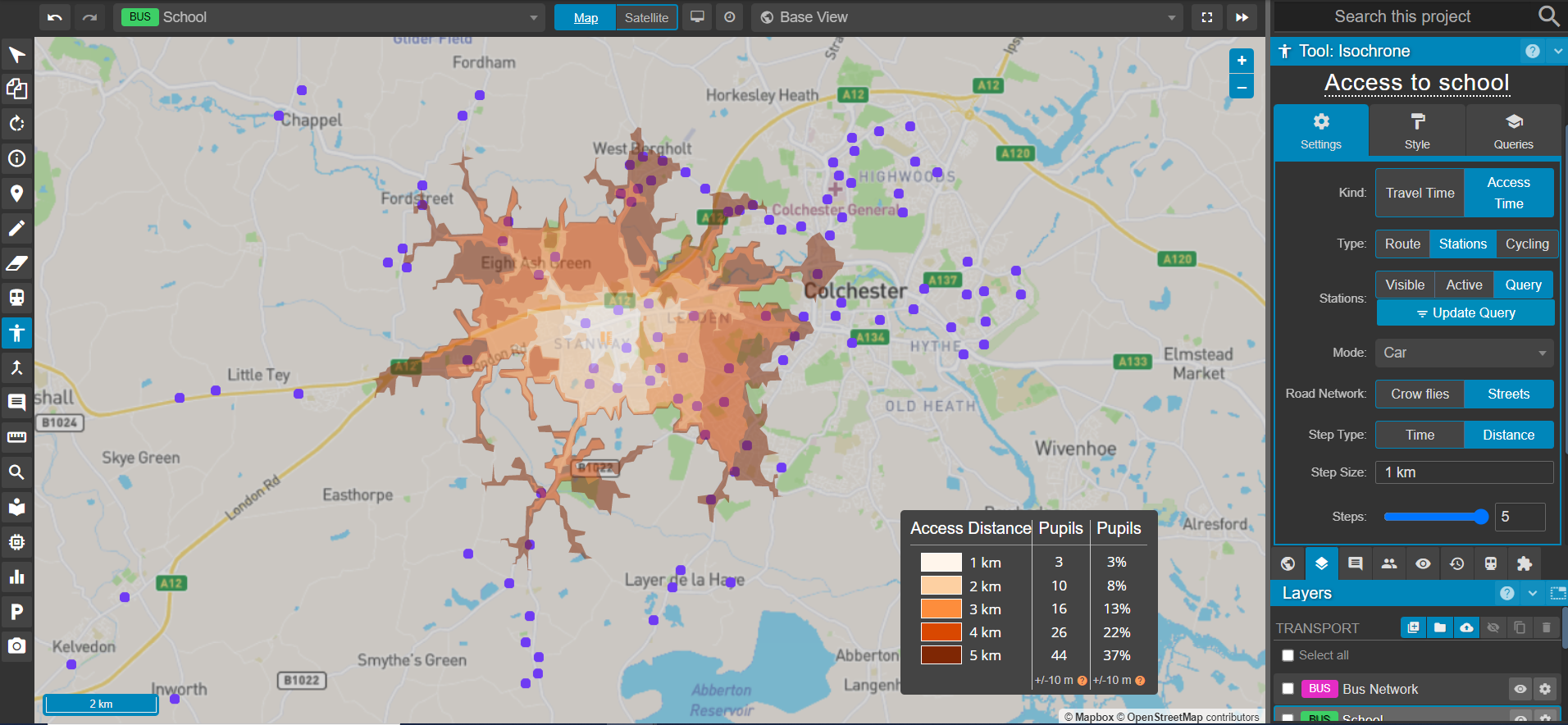
Exploring school catchment with isochrones in Podaris
Ultimately, a blend of tools for informing the decision-making process at the feasibility stage, and enforcement post-delivery will be neccesary to create school streets and transport solutions that marry convience with the safety and environmental prorities of the future. Podaris exists for the early stages of such planning, helping you to rapidly create and compare scenarios without sacrificing accuracy in your calculations.
If you'd like a complete tour of how Podaris allows you to unlock data to better understand the impact of travel options across every mode, schedule a demo with us today.